
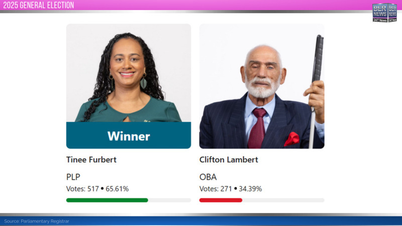
The 2025 General Election saw a two-way race, with the incumbent Tinee Furbert [PLP] winning the seat with 517 votes [65.61%] while the OBA’s Clifton Lambert was second with 271 votes [34.39%]. Since the one seat system started in 2003, the PLP have won it four times and the OBA and UBP have won it once each.
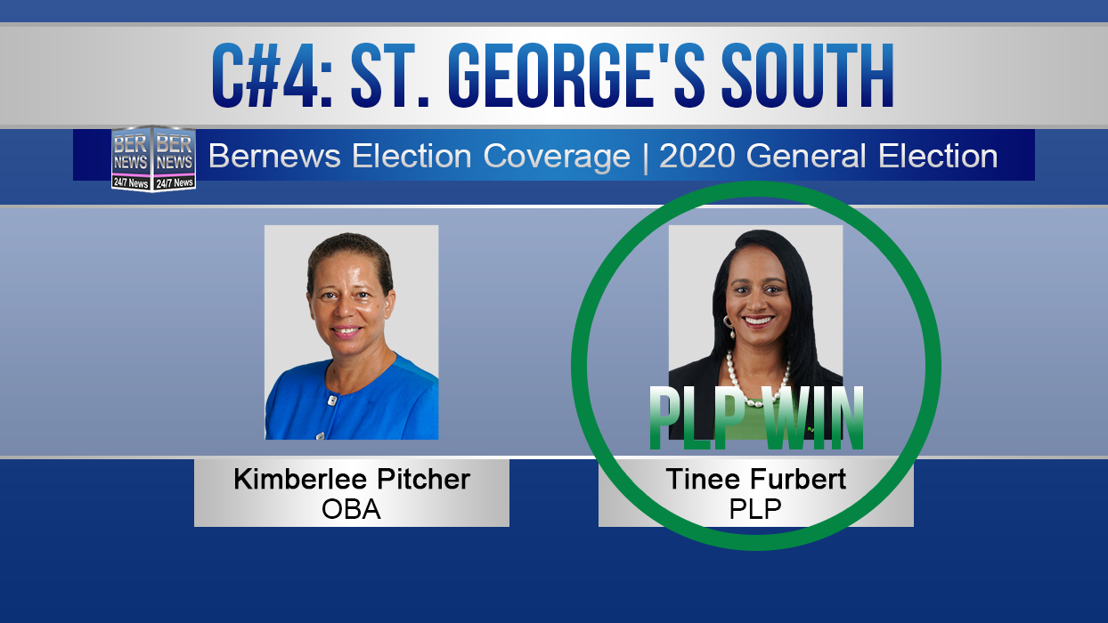
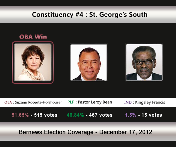
- 2020 Winner – Tinee Furbert [PLP]
- PLP’s 2020 Candidate – Tinee Furbert
- OBA’s 2020 Candidate – Kimberlee Pitcher
- FDM’s 2020 Candidate – No FDM candidate
The Constituency Boundaries Report [PDF] states: “Constituency #4 St George’s South shall be all that land contained within a line drawn from the junction of North Shore Road with Fractious Street; thence North-West to a point on the coastline; thence continuing North-East along the coastline including Coney Island; thence South-East along the coastline to a point on the coastline at Blue Hole Hill; thence North-East along the west face of the Causeway to the Longbird Bridge; thence continuing along the coastline around Stonecrusher Corner and Stocks Harbour and the coastline of St. George’s Harbour and Smith’s Sound to a point on the coastline West of the junction of Dolly’s Bay Road and St. David’s Road; thence East to the junction of Dolly’s Bay Road and St. David’s Road; thence North-East along the centreline of St. David’s Road to the junction with Pepper Hall Road; thence South along the centreline of Pepper Hall Road to a point that aligns with the centreline of Bee Hive Drive; thence West along the centreline of Bee Hive Drive to the junction with The Sink Road; thence South along the centreline of The Sink Road to the junction with Tommy Fox Road; thence West along the centreline of Tommy Fox Road to the junction with Southside Road; thence East along the centreline of Southside Road to the junction with Cooper’s Island Road; thence South-East to a point on the coastline; thence South along the coastline and including Cooper’s Island and continuing around the coastline of the Airport to the North end of the Causeway at the Longbird Bridge; thence South along the east face of the Causeway to Blue Hole Hill; thence South-West along the centreline of Blue Hole Hill to the junction with Wilkinson Avenue; thence South along the centreline of Wilkinson Avenue to the junction with Harrington Sound Road; thence South to a point on the coastline; thence West along the coastline to a point on the coastline South of the junction of Trinity Church Road and Bayside Lane; thence North to the junction of Trinity Church Road and Bayside Lane; thence North-West along the centreline of Trinity Church Road to the junction with Wyndham Hill Road; thence East along the centreline of Wyndham Hill Road to the junction with Mount Wyndham Drive; thence North along the centreline of Mount Wyndham Drive to the junction with Sunrise Drive; thence North-West along the centreline of Sunrise Drive to the junction with Fractious Street; thence North-West along the centreline of Fractious Street to the junction with North Shore Road, and shall include Brook’s Island, Burt’s Island, Hen Island, Peggy’s Island, Smith’s Island, Humpback Island, Pilot Island, Horseshoe Island, Higgs Island, Paget Island, Governor’s Island, Bremen Island, Grazbury’s Island, Nonsuch Island, Idol Island, Brangman’s Fort, and Coney Island.“